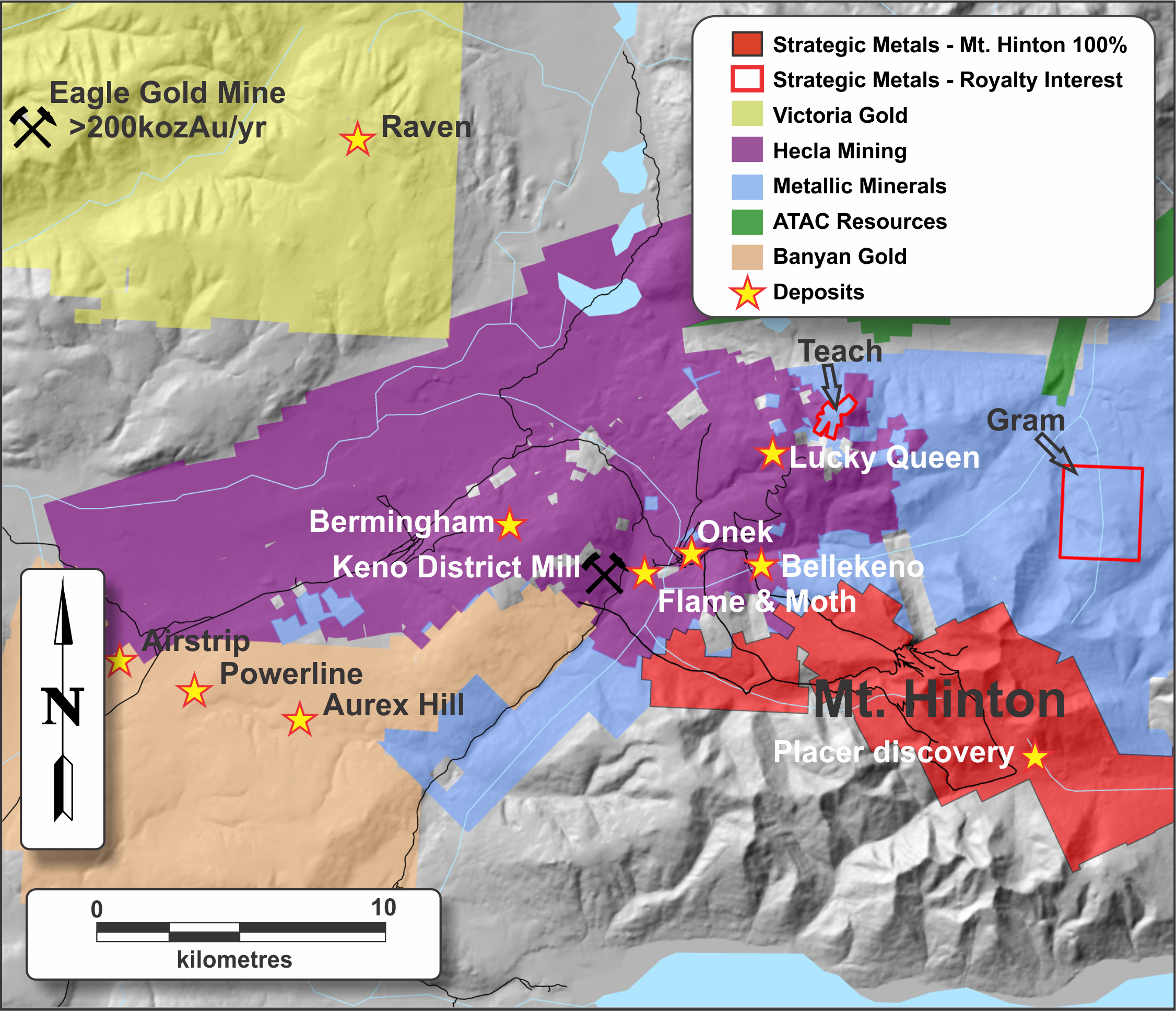
Mount Hinton
-
Under Option to Trifecta Gold Ltd. as announced March 4, 2024
-
Multiple undrilled high grade gold and silver veins
-
Adjacent to Hecla’s Keno Hill Mines
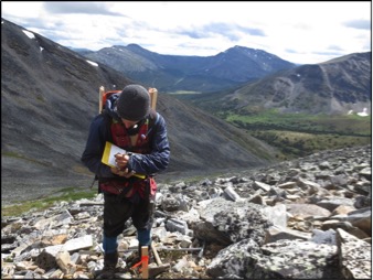
The Mount Hinton property lies within the world-famous Keno Hill silver mining camp, a district that hosts more than 35 individual mines and is historically Canada's second largest primary silver producer. The property covers an 83 sq km area that is located 10 km by road from Keno City in central Yukon within the traditional territory of the Na-Cho Nyak Dun. A hydroelectric power grid extends to Hecla Mining's Keno Hill mine and mill complex, which is located three kilometres north of the Mount Hinton claim block.
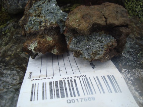
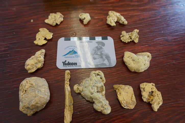
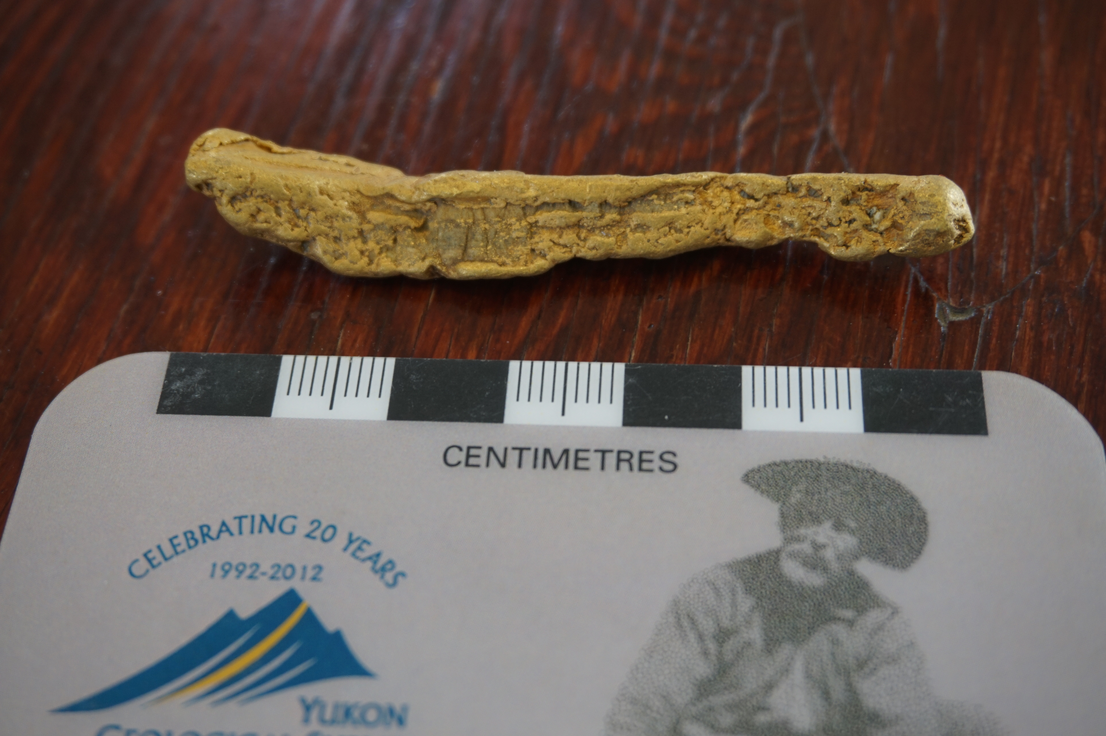
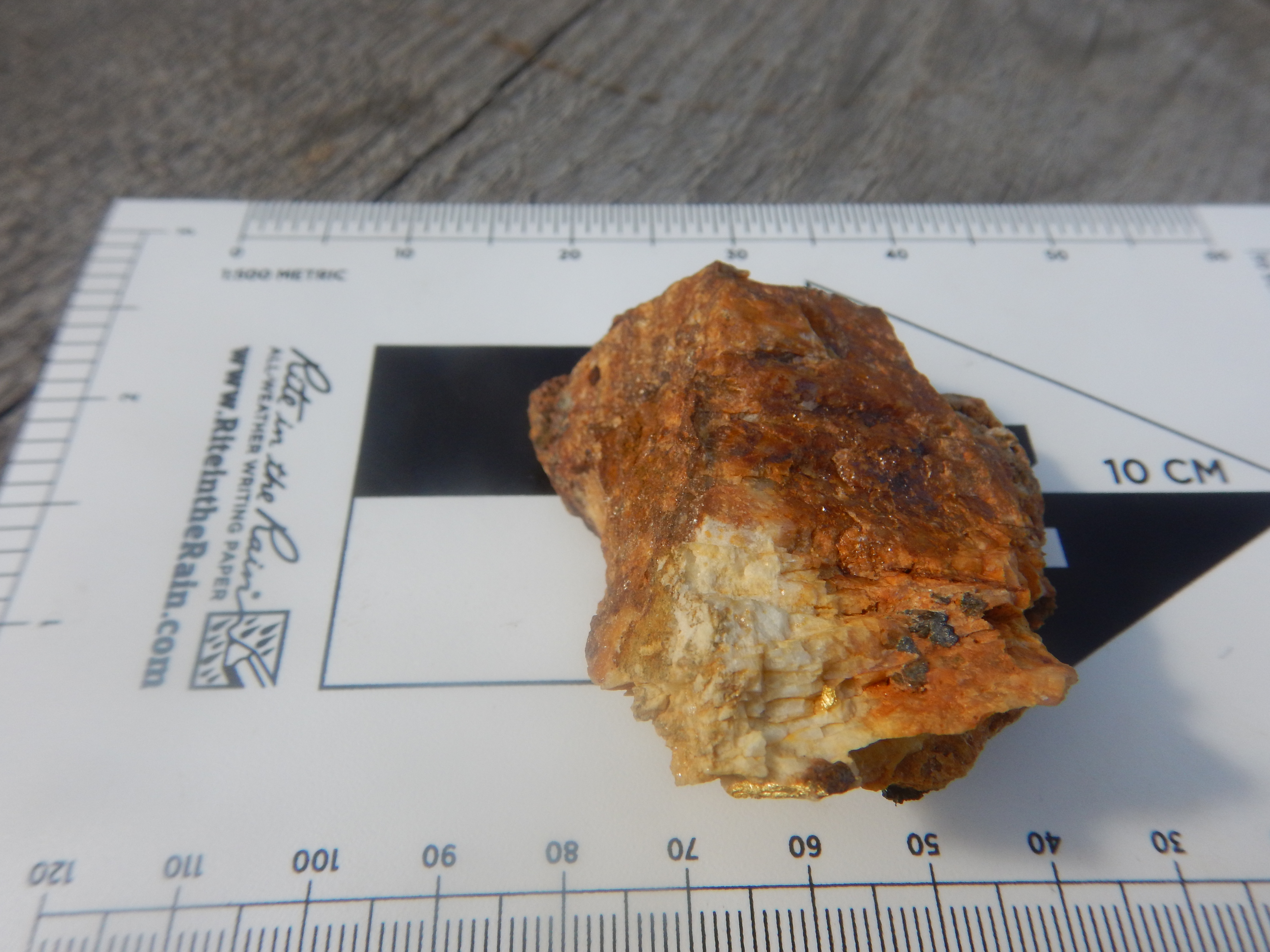
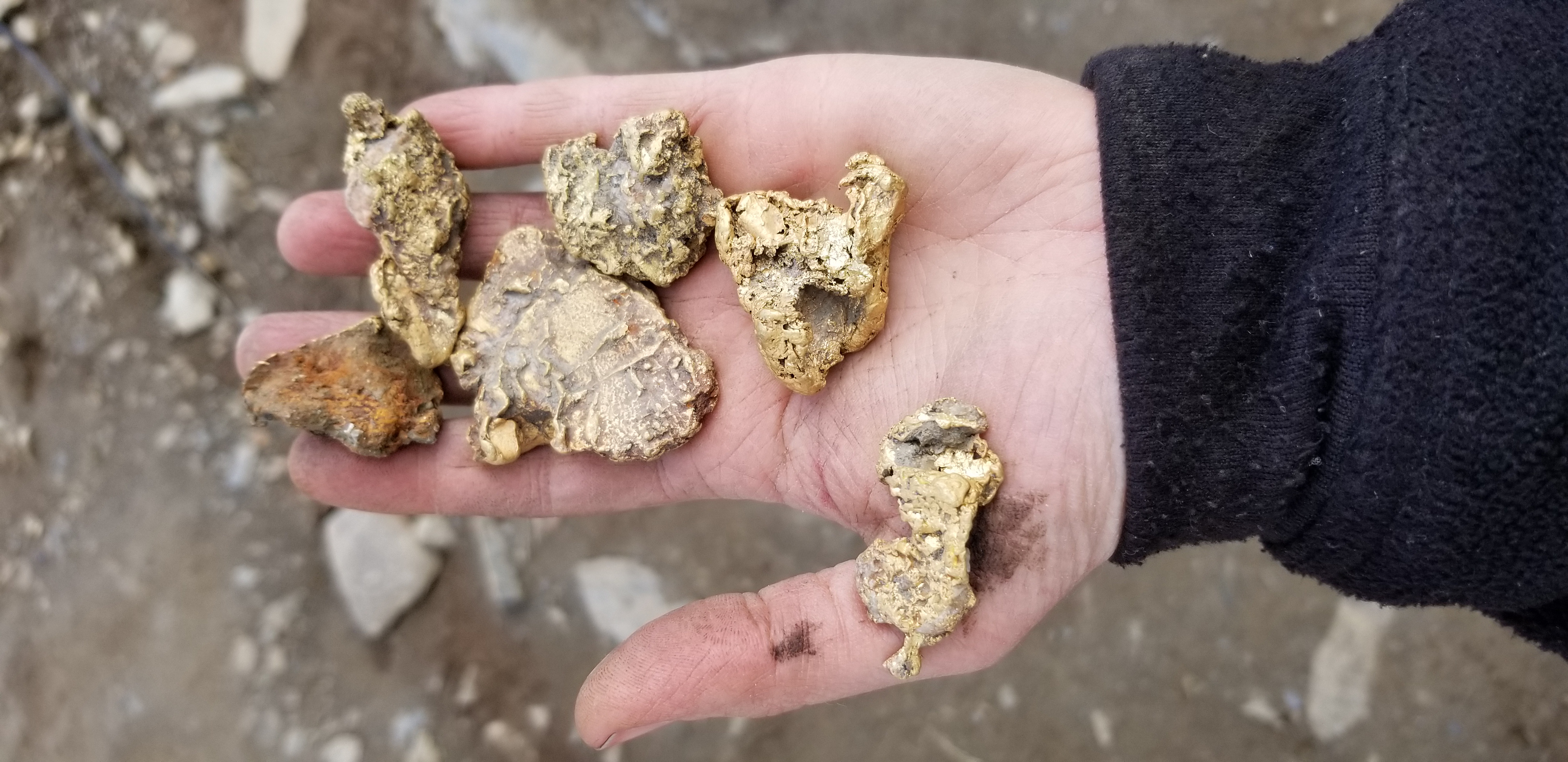
Although silver mineralization is found in veins on the Mount Hinton property, gold is the most significant component in many of the 73 bedrock showings and float occurrences that have been discovered to date. Mineralized shoots on the veins typically grade between 1 and 30 g/t gold, 50 and 1500 g/t silver and 0.5 to 2.5% lead. Maximum grades of 2,340 g/t gold, 30,822 g/t silver, and 75% lead have been returned from rock samples. Creeks draining the property have yielded significant placer gold production and are still being mined. Previous operators identified numerous soil geochemical anomalies and geophysical targets that have not yet been drilled or trenched. The project is permitted for advanced exploration.
Highlights from phase one of the 2019 exploration program include:
- The discovery of a linear train of vein quartz and brecciated vein, extending 230 m northeasterly from a talus sample that assayed 2340 g/t gold and 597 g/t silver to an outcrop of altered and oxidized breccia grading 33.3 g/t gold and 654 g/t silver.
- The identification of a parallel train of vein quartz and breccia, located 150 m to the east, where float samples returned:
- 6.11 g/t gold and 165 g/t silver;
- 1.64 g/t gold and 363 g/t silver, and;
- 2.03 g/t gold and 306 g/t silver.
- Rock samples from other parts of the main soil anomaly include 15.9 g/t gold with 9.6 g/t silver and 9.26 g/t gold with 1.59 g/t silver
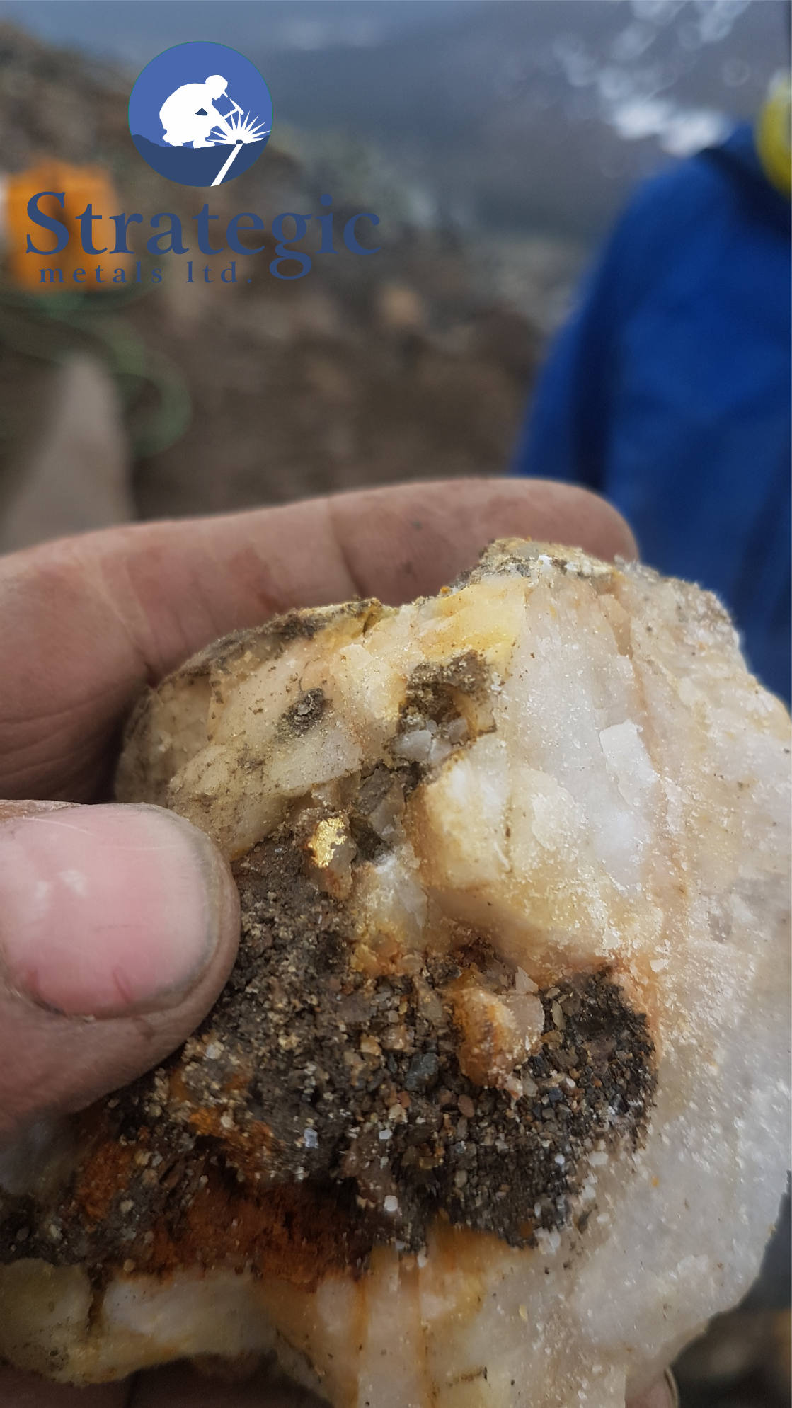
During phase two of the program, the site of the multi-ounce gold sample was re-examined and visible gold was discovered within limonitic vein quartz float. A rock sample collected 120 m along strike to the northeast yielded 202 g/t gold and 2020 g/t silver. Large blocks and finer talus of vein material mixed with oxidized brecciated vein quartz were also found in several, nearby linear structures. Sporadic outcrops of mineralized, breccia and vein quartz show that these structures strike northeast and dip steeply southeast, and suggest that the mineralized talus is close to its bedrock source.
Mapping and prospecting during phase two discovered numerous mineralized veins elsewhere within the Granite Creek drainage including:
- A one to two metre wide vein, intermittently exposed along a 75 metre strike length, where four widely-spaced rock samples returned: 28.5 g/t gold; 23.5 g/t gold with 1720 g/t silver; 11.6 g/t gold; and 4.44 g/t gold.
- Another outcropping vein, found within a fault zone, graded 12.6 g/t gold and 2100 g/t silver.
- A second exposure within the same vein fault was located 50 m along strike, where chip sampling returned 30.5 g/t gold and 53.1 g/t silver over 1.2 m and a grab sample assayed 48.5 g/t gold and 74 g/t silver.
- A third, 50 cm wide vein in outcrop, which is covered by talus along strike in both directions, assayed 46.9 g/t gold and 446 g/t silver.
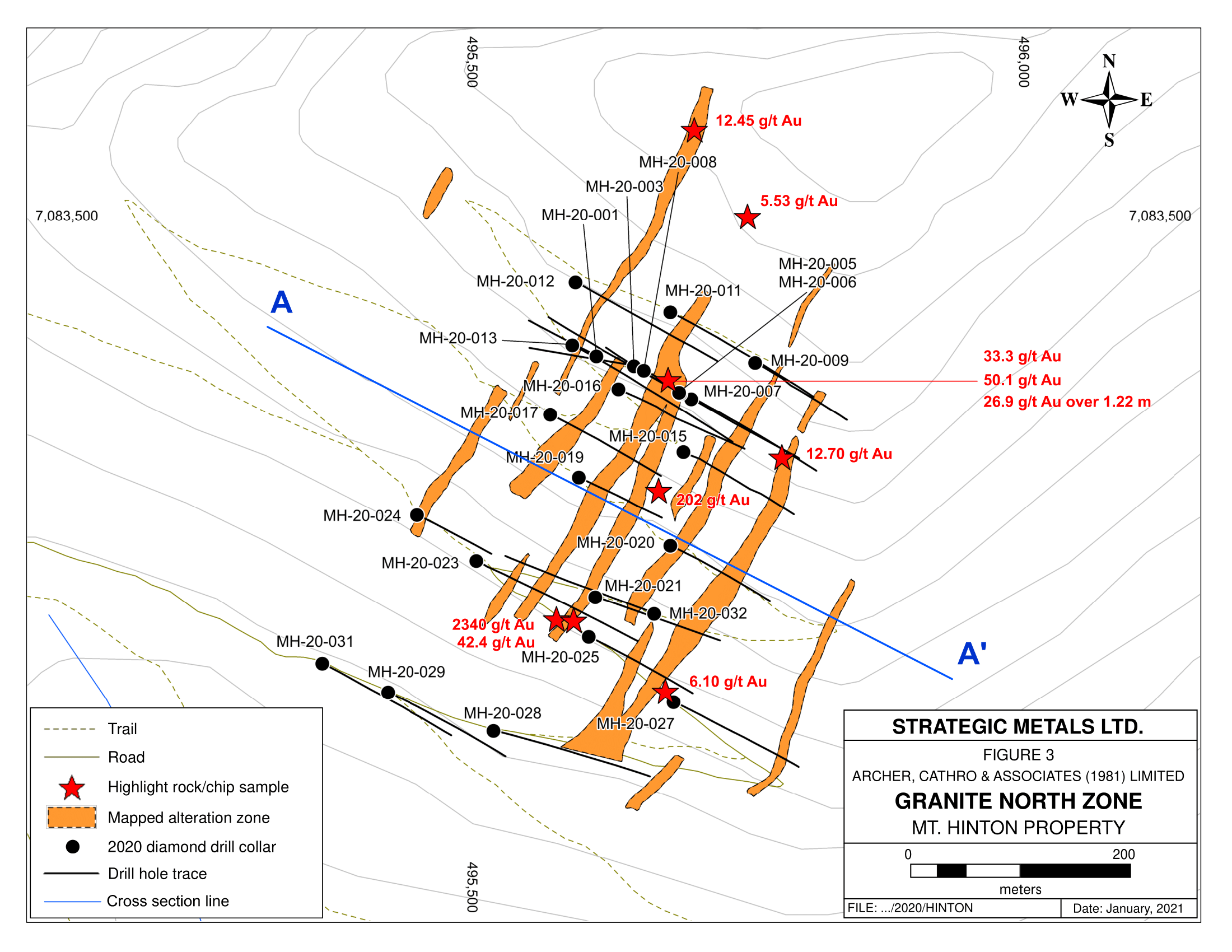
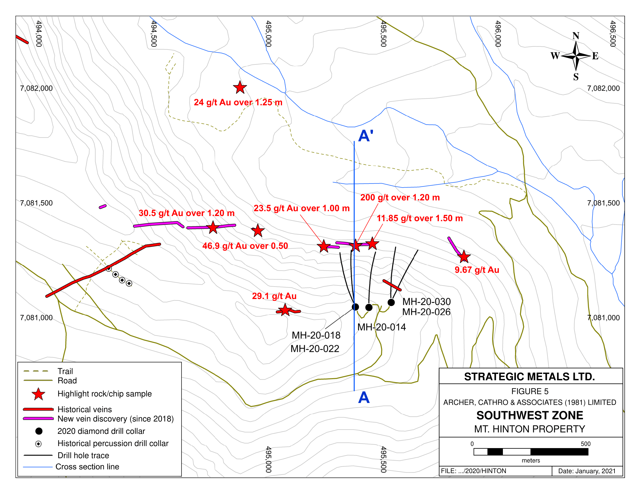
Highlights from 2020 chip sampling include:
1.2 m grading 200 g/t gold and 90 g/t silver from the South West Zone
1.22 m grading 26.9 g/t gold and 49 g/t silver from the Granite North Zone
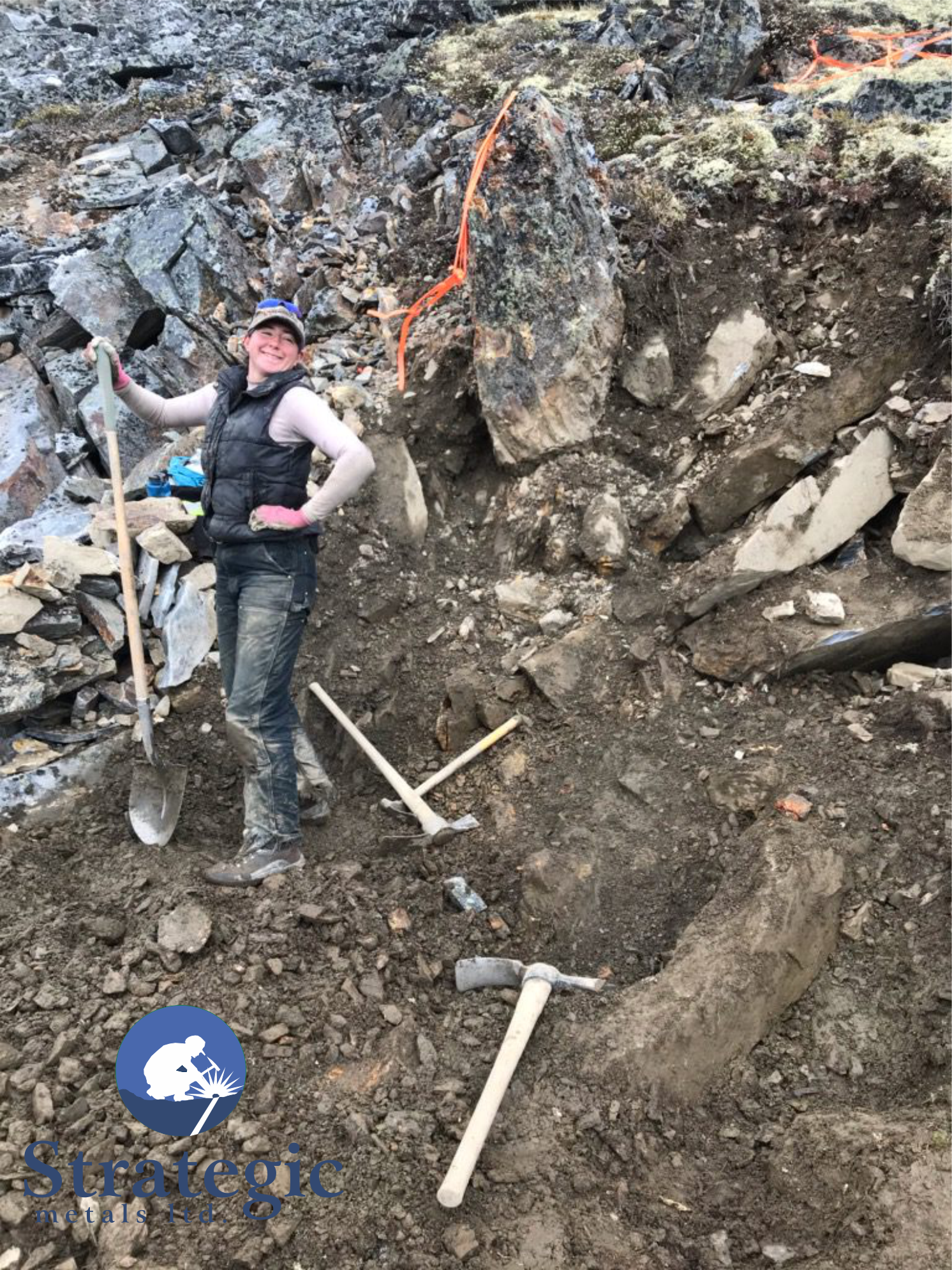
At the South West Zone, continuous chip sampling was completed at two locations, 10 m apart, on a newly-discovered vein. One chip sample yielded 200 g/t gold with 90 g/t silver over 1.2 m and the other sample graded 80.3 g/t gold with 72 g/t silver over 1.0 m. The hanging wall and footwall of this vein were poorly exposed and were not sampled. Only minor amounts of sulphide minerals were noted in these samples. Visible gold was reported in the higher grade sample.
At the Granite North Zone, continuous chip samples of bedrock were collected across parts of a vein exposed in a hand trench, at two locations spaced 1.35 m apart along strike. Neither the hanging wall nor the footwall of the vein was exposed at either location. The first samples returned 26.9 g/t gold with 49 g/t silver over 1.22 m and the other sample assayed 6.29 g/t gold with <5 g/t silver 1 m. Visible gold was noted in the lower grade sample, but neither sample contained significant sulphides. The chip sampled hand trench is situated about 250 m uphill of the bonanza grade float sample discovered in 2019.
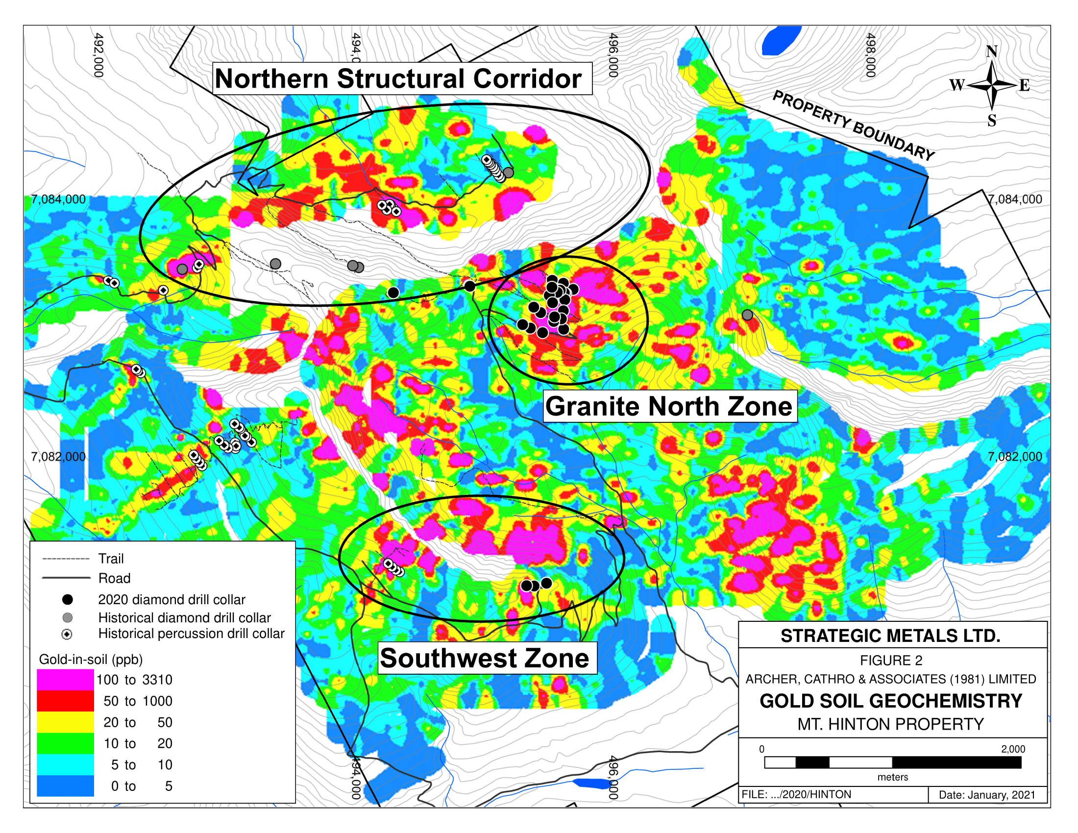
The South West and Granite North zones lie 2 km apart on opposite sides of the Granite Creek Basin, near the center of the Mt. Hinton property. The Granite Creek Basin is a glacial valley with steep, mostly-talus covered slopes flanking a broad, till-covered floor. Gold veins have been discovered on the slopes and in a few short excavator trenches that have been dug into the valley floor. The veins are hosted by the same quartzite unit as hosts the uncommonly rich silver veins that characterize other parts of the prolific Keno Hill district. The Granite Creek Basin is located within a larger, 6 km by 4.5 km, area that is defined by mineralized veins and strongly anomalous gold-in-soil geochemistry. Placer operations are working in all creeks draining the area of veining and anomalous geochemistry.
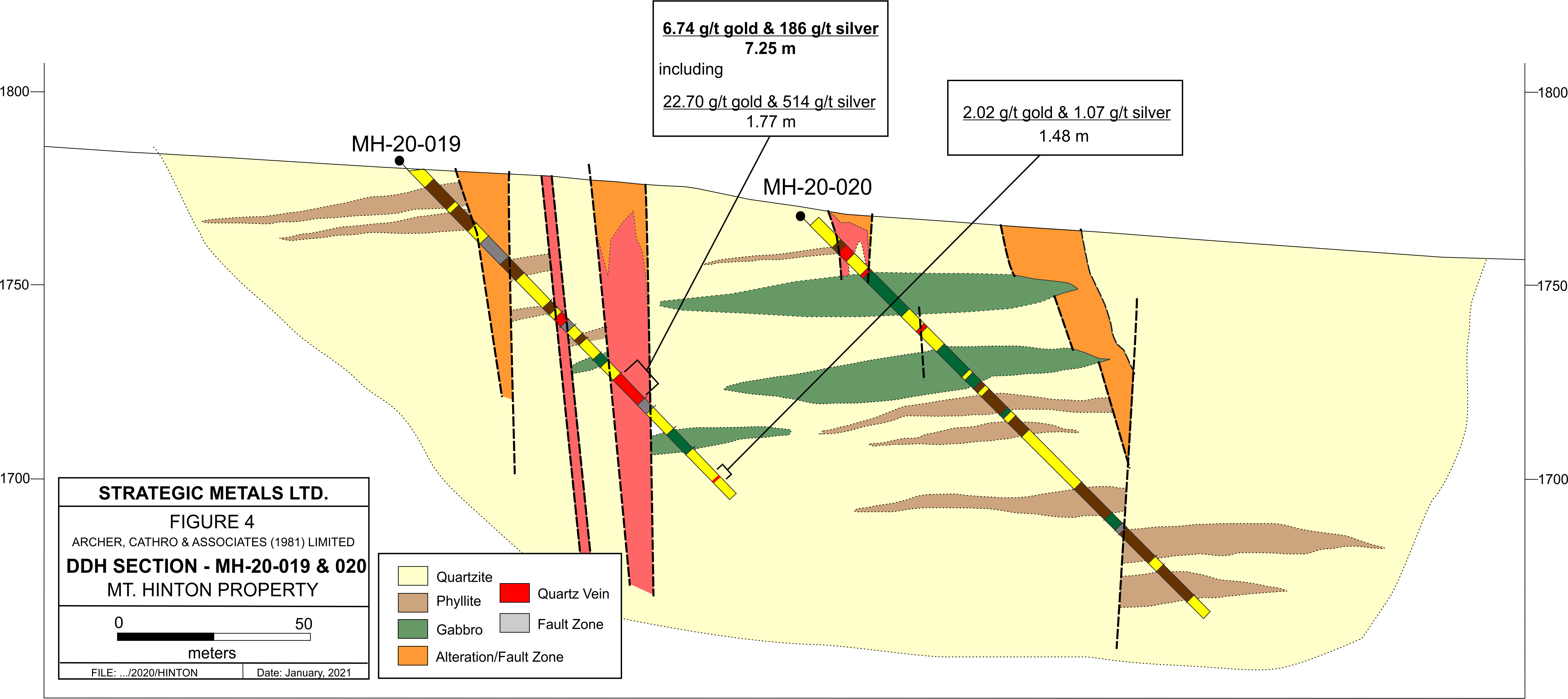
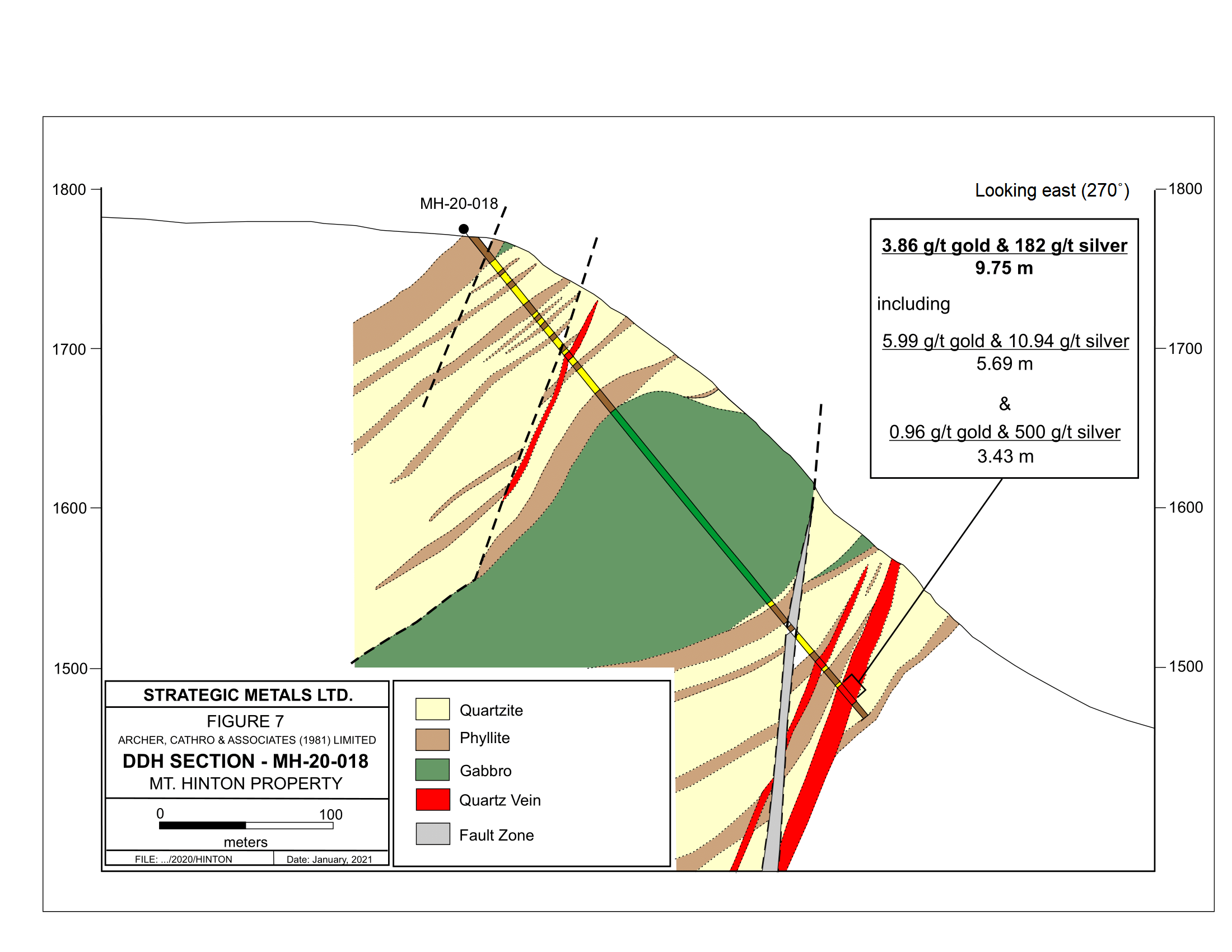
The 2020 program at Mt. Hinton included 6,978 m of HQ diameter, diamond drilling in a total of 32 holes, with 24 holes in the Granite North Zone, five holes in the Southwest Zone and three holes in the Northern Structural Corridor.
Highlights from the drill program include:
- 6.44 g/t gold over 12.14 m including 42.7 g/t gold over 1.55 m, in hole MH-20-022 (Southwest Zone);
- 3.86 g/t gold and 182 g/t silver over 9.75 m, in hole MH-20-018 (Southwest Zone);
- 6.74 g/t gold and 186 g/t silver over 7.25 m, including 1.77 m grading 22.7 g/t gold and 514 g/t silver, in hole MH-20-019 (Granite North Zone);
- 17.00 g/t gold over 1.56 m, in hole MH-20-032 (Granite North Zone); and,
- 9.57 g/t gold over 1.47 m, including 0.52 m grading 25.8 g/t gold, in hole MH-20-023 (Granite North Zone).